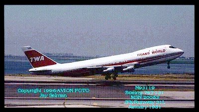
THE DOWNING OF TWA FLIGHT 800~TERRORISM ?OR...
WAS THE EXPLOSION OF TWA FLIGHT 800 Terrorism and covered up, or was it something that our own Navy /Coast Guard did by accident and it was till covered up so that insurance would pay off the familes involved. Give me your views and comments. Go to the link below and download google earth for free. Look over all the diagrams and read the statements by the people that saw it explode and go down. Consider all that would have been involved if the real truth was told (if what the conclusion was said to be was not true) ! Why are there so many believed coverups done in this country" if " we have been lied to about so many things. I personally do not beleive the plane exploded and if that is the case here why have we been lied to. I do not claim to know this to be the truth but things just do not add up. I am not one to get invloved in conspiracy theories about many things but this one does have me thinking.

THE DOWNING OF TWA FLIGHT 800
Google map used to bolster missile claim
Researcher verifies testimony of key FBI witness
http://www.worldnetdaily.com/news/article.asp?ARTICLE_ID=49593
A researcher of the TWA Flight 800 downing says his use of the map program Google Earth to verify the claims of witnesses bolsters his belief that the 747 jetliner was shot down by a missile, contrary to the official explanation.
Robert Donaldson, who has carried on the investigation of his brother, the late Cmdr. William Donaldson, re-interviewed a key witness, Mike Wire, whose testimony was used to create the government's explanation.
Nearly 10 years ago, after an extensive investigation, the FBI and National Transportation Safety Board declared "mechanical failure" the cause of the July 17, 1996, disaster but failed to adequately explain how it happened.
Donaldson said the investigation created an "environment of suspicion and distrust in the government's motives and conclusion."
"Throughout all of this, they have ignored and tried to discredit more than 100 eyewitnesses who saw a streak, or fireworks rise from the surface and impact Flight 800," he said.
Wire's case is a perfect example of this bias, contends Donaldson, who went with the Pennsylvania man back to Long Island to take a photograph of the view and analyze it.
Donaldson said what he created is nothing like the CIA described in its now-discredited video that featured a distorted version of Wire's testimony.
Wire, according to his testimony to the FBI, was looking south-southwest toward the beach. At approximately 8:30 p.m. he saw a white light traveling skyward from the ground at approximately a 40 degree angle. He described it as a white light that sparkled and thought it was some type of fireworks.
Wire stated the light "zigzagged" as it traveled upward and at the apex of its travel, it "arched over" and disappeared from view. He estimated the light was in view for about 15 seconds and its speed was consistent with normal fireworks.
The CIA video contended that what the witnesses saw was "a Boeing 747 in various stages of crippled flight." The video climaxed with an animation purporting to show the nose of the aircraft blew off from an internal explosion.
TWA Flight 800 then allegedly "pitched up abruptly and climbed several thousand feet from its last recorded altitude of about 13,800 feet to a maximum altitude of about 17,000 feet." The CIA video claimed this was what the eyewitnesses had seen – not missiles, but a rocketing, noseless 747 trailing fire.
Donaldson said Wire's testimony was used extensively by the CIA in developing its theory.
But Wire says the agency completely distorted his statement and never interviewed him.
After his recent interview with Donaldson, Wire went to the location and took a digital photo, on which he then drew black lines indicating the route of the smoke trail he saw and the path of the burning debris falling to the ocean.
Donaldson then edited the picture to show more of what Wire described to him.
Using Google Earth, Donaldson then plotted Wire's position on the bridge, the exact location of Flight 800 according to the Islip radar and then overlaid his drawing on the perspective in Google Earth.
"This has resulted in an extraordinary match up between his recollection and where the events took place according to the Islip radar," Donaldson said.
The pictures show the CIA's explanation is "complete bunk," he said.
Flight 800 already was at 13,700 feet, well above the rooflines of the building Wire was looking at and high in the sky. A climb of 3,000 additional feet would be imperceptible, Donaldson argued, only 20 percent higher than its original position.
It also would not look like a zigzagging streak with a smoke trail that originated behind one of the beachfront houses.
Furthermore, Donaldson contended, if Flight 800 did manage to climb 3,000 feet, it would take between two to three minutes, yet the Islip radar only shows it in the air for only 37 seconds after the initial transponder was lost.
"The only conclusion that can be drawn from this and other similar eyewitness accounts is that they saw something that was supersonic," he said.
Donaldson said readers can link to his Flight 800 Google Earth Project, after installing Google Earth, by following the instructions below.
Open Google Earth.
On the top menu bar, click on "ADD".
Then click on "Network Link".
Fill in the name field with "TWA 800" or another name to describe it.
Add the following link in the "Location" box: http://twa800.com/google-earth/flight-800.kmz
This should open a network link to the Flight 800 data. Click the triangle beside the link to expand the data. Double Click any link to "fly" to that location. Clicking on and off the check boxes will display or hide that information.
ANOTHER GOOD LINK.
http://www.whatreallyhappened.com/RANCHO/CRASH/TWA/ORIG_PLANE.html


0 Comments:
Post a Comment
<< Home